Category: B09. Drawings’ Types

  • B09.03. Footprint

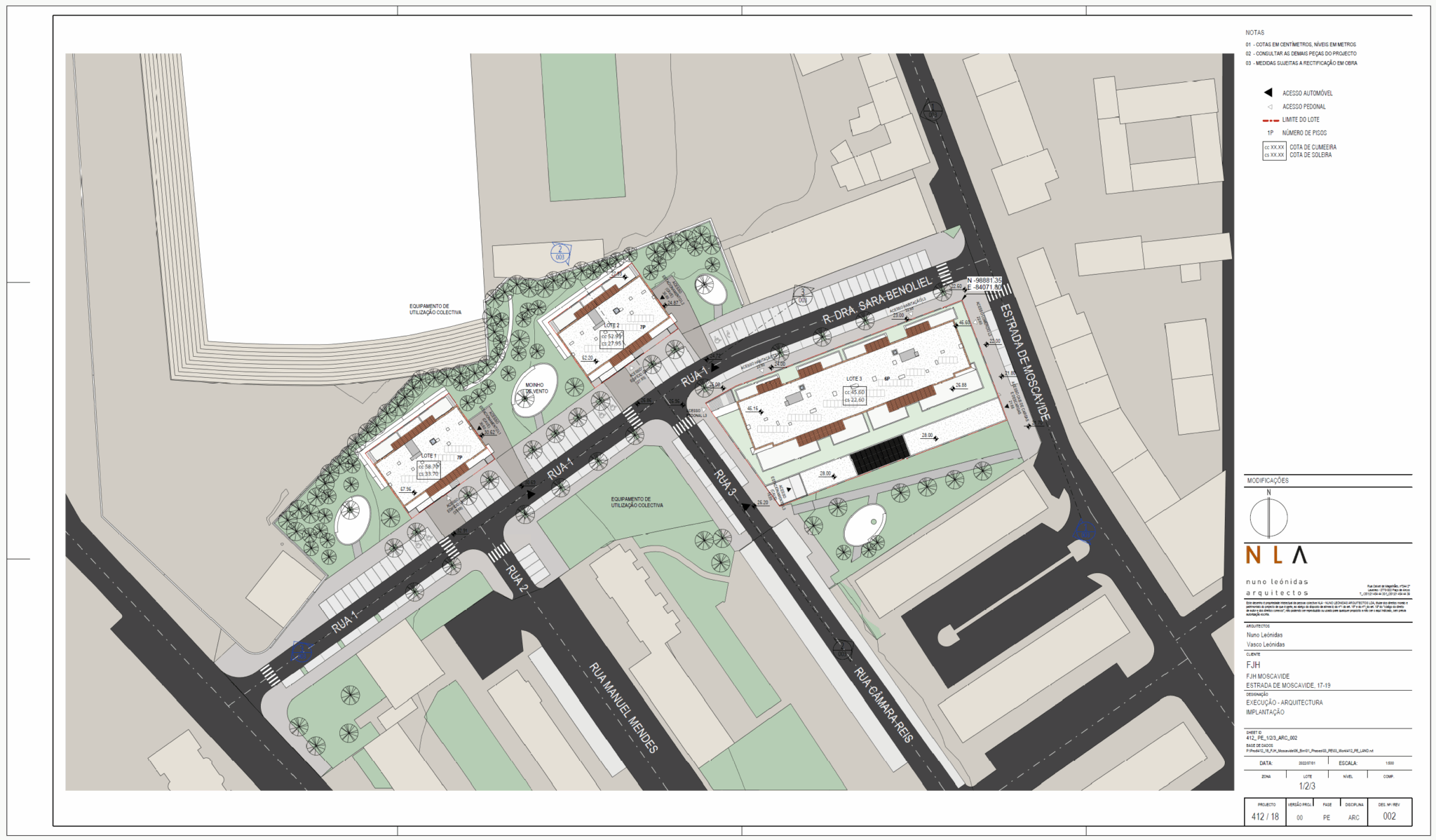
    This type of plan must be presented at scale 1:500. It must locate the buildings in the plot site and identify the several buildings and relative accesses, general dimensioning, ground floor elevation, and the different top elevations of the buildings.

  • B09.01. Topographic Plans

    Presented at scale 1:500,1:200 or 1:100, depending on the size of the project, it must include the level contours the coordinated points, referenced according to the proper coordinated system. The boundary plot and existing elements should also be included.

  • B09.02. Location Plans

    Presented at scale 1:1000 or smaller scales. It must be used to identify the local of the project and to give it some geographical context.

    Usually given by the official authorities.